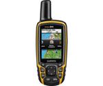
Garmin GPSMAP 64 - Reviews
(4.3)
121 reviews
Info
Reviewbucket.co.uk scanned the internet for Garmin GPSMAP 64 reviews.
You can find all Garmin GPSMAP 64 reviews and ratings on this page.
Analysis
For Garmin GPSMAP 64, 121 customer reviews collected from 1 e-commerce sites, and the average score is 4.3.
Detailed seller stats;
Amazon has 121 customer reviews and the average score is 4.3. Go to this seller.
Similar Items
3.11.2015
I have been using a Lowrance iFinder H2O for years. It has served me well. I am only replacing it because the screen has become hard to read at times. It is a black and white model with no real maps. I put a Topo software on it. But it is just elevation lines.The Garmin was a nice upgrade. I have a real color Topo map on it. I purchased the $30 map through Garmin. I have noticed the map is a little out of date with new roads not showing up though. The Garmin loads up a lot faster than the Lowrance did. Even in heavy cloud cover and thick tree canopies. It can also find me indoors. It also does a good job of tracking me while in my pocket too. I am still getting use to it.
28.10.2015
I use this for mountain biking. The coverage in the thick Mendocino coast redwood forests has been very good for navigation and tracking but the altitude readings go way off with the base unit. If you really want to record your climbing then get the next model up (64S) since it has a barometer for about $45 more. I find the track summary page hard to read while riding but it is a small screen. I may need to play with the settings in order to see the speed and distance covered without stopping to look closer. However, the map screen is clear and is easy to see your relative distance to the destination and the overall track since you can zoom in and out with a push of a button.
24.3.2018
My only reservation: the unit is slightly chunkier than expected, but fits well in the hand. I found the latest E-trex models too small and fiddly. Having more buttons means direct access to pages with less menus to work through. It is also easier to use with gloves on.The screen is large enough and text easily read (again an improvement over e-trex). Initial aquisition is quite fast (eg when switching on after driving hundreds of miles!). Being able to use a rechargeable power pack, but also normal AA cells is great and should save money. I haven't loaded any maps yet, but I found the base map is actually quite useful, though definitely not for walking.
26.1.2019
Had this for 3 years now. I find it accurate and reliable. Having the ability to use 'normal' batteries means no worrying about battery life when out hiking.I picked up non garmin mapping on a 4gb memory card and that works a charm. OS maps down to 1.50000.Chunky buttons work nicely with gloves on. I have the soft case on mine so the device still looks new when I get it out.You can set the coordinates to British Ordinance Survey then its well cheating really but you can find yourself on the paper map quickly. Useful for 'confirming' your position after a detour.I dont want wireless or blue tooth or a camera or any thing else on a GPS, I want a GPS to find my position and tell me where I am.
17.8.2015
Single minded and very accurate GPS. Use on road and mountain bikes and it performs the task of navigating perfectly. Far better than other cycle specific GPSs which often loose track of location.The buttons (as opposed to touch screen) work in all weather and with gloves with a re-assuring beep (if you turn on sound) every time you push a button. Using a touch screen in the rain, with or without gloves, while moving is a frustrating exercise, so having all buttons is a good thing.Screen is easy to see in daylight and at night without affecting night vision much.Easy to download good detailed maps for free,
7.8.2017
I bought this model of GPS because my 14 year old model could not be updated and was not accurate enough. I specifically needed it for work as a bridge builder working abroad in this instance whilst inspecting bridges in Tanzania. At first I found the instrument to a little complicated and was on the point of returning it, however, a visit to a local camping shop (no luck) and a lot of effort and I found this GPS to be highly accurate. The instrument switches on quickly and picks up satellites within seconds. I did not buy a map package and nor did I need one. I cycled through the menus using a button the side switching from lat/long to grid without effort. A pair of AA batteries lasted for about 1 1/2 days of constant travel.
18.9.2015
I've been looking at a handheld GPS for the past couple of years for hiking but up until now I didn't really hike anywhere that I would be worried about getting lost. I bought the base model of this device because I don't need the ANT/Bluetooth features nor did I want to buy Garmins topographical maps. If you don't mind a little effort you can easily get great 24K topographical maps for free (not pirated, legit maps). I used this when I went hiking last week down at Red River Gorge, it was great.Here are some tips :Make sure you download the Garmin Express software and update the firmware on the device as soon as you get it.Use the Garmin Basecamp software to plot your course before leaving,
13.12.2016
So I actually sent my gps unit back. I didn't realize you needed to spend extra money to obtain maps (not willing to do at the moment) and I actually didn't need it at the moment after I thought about it because winter I will not be backpacking as much. It was a neat unit though and seemed very accurate testing it out in town, but without maps it isn't that useful unfortunately. You can't be in a building or else it won't pick up the signal either (fairly obvious reason). I did like all the features it had. It was also relatively small and lightweight. A lot to figure out right away though so spend some time with it before using it for an extended trip. If I had to buy it again,
26.3.2015
My old GPSMAP 60 is on its last legs so I picked this one up. In hindsight I should probably have gotten one of the models with bluetooth connectivity, this one doesn't have that. These units are tough as nails, accurate and reliable under thick tree cover. I spend a fair amount of time off the track in unfamiliar areas for both work and play, so this comes in handy. Like most folks, I use my phone to navigate in the car. I use my GPS more for mapping and navigating in the boonies. I really like ability to load custom maps. If you have an android phone or tablet you should check out the Custom Maps app. It lets you take a picture of a paper map and quickly geo-reference it using google earth.
31.5.2016
This GPS unit will lock on to satellites VERY quickly, even fresh from the box. When I first turned it on, it was simply to browse the menus, but I was surprised it was able to accurately lock on to my position even inside my room (location later verified through ArcGIS and it was only off by 9 feet...from inside a room!) I found my first geocache this past weekend which was fun, and I use it regularly for light surveying of public utility features for my job. I save those as waypoints and import them into ArcGIS for positional accuracy, and although it's certainly not survey-grade, it's awesome for the quick and dirty and is surprisingly accurate (within about 3 feet I'd say).
23.11.2015
Moved up from the Garmin Etrex, which was a good basic model for Geocaching. However this model is the business. I love everything about this GPS., especially the accuracy and the fact that it holds so many caches on the large drive. I won't miss the little joystick on the Etrex and find the push-buttons to be easy to use - even while wearing gloves. It's user friendly and solid. Purchased with the optional cover and belt clip, I now have everything I need. Also downloaded some excellent maps from talkie toaster, as the map that was on there was next to useless. But the price was a bargain, so no complaints at all.
11.11.2015
I used to have a garmin years ago and the biggest frustration was the length of time (or inability) to establish a satellite reception. No such issues with this device which seems even able to establish rough position inside when beside a window. Lots of good features. Slight downside is that the buttons and user interface doesn't always feel intuitive but shouldn't take too long to learn. Haven't used in the hills yet but impressions very good so far. Note it does not come with topographical maps however! I was aware when purchasing, but pictures of device perhaps give impression that they do.
15.4.2018
Upgraded from an older GPSMAP 60CSx that had the rubber casing damaged (my fault) after years of perfect use. I was skeptical before buying the new one - a lot of reviews said the 64 series wasn't as good. Not true at all - I'm a very fussy GPS user and it works better than the old unit. Finds the satellites quickly and with good accuracy. Only complaint I have is some UI functions are unintuitive - difficult to find how to temporarily turn track generation off and how to cancel out of routing mode. Still, works very well - 5 star device, use it for hiking and kayaking.
17.11.2015
Many people think that their cell phones do it all for them regarding GPS, but unless they bought the $800+ cell phone with the GPS chip installed, they are only as good as the signal you get from the cell tower. This unit, however is very handy and I like having a real GPS unit to carry when I go hiking. Color display is good, menu selection is good, and it is rugged, fits well in the palm of your hand, or in your backpack, etc. Great system.
4.12.2018
Got it for both of my parents. Both over forty. Love how big the button and screen are, making it easier for my parents to see. The only reason why I gave a four stars instead of five is because there wasn't much instructions. Since it was my first time using any kind of hiking gps, it took me a while to understand the terminology. But after that, teaching my parents how to used it was pretty easy.